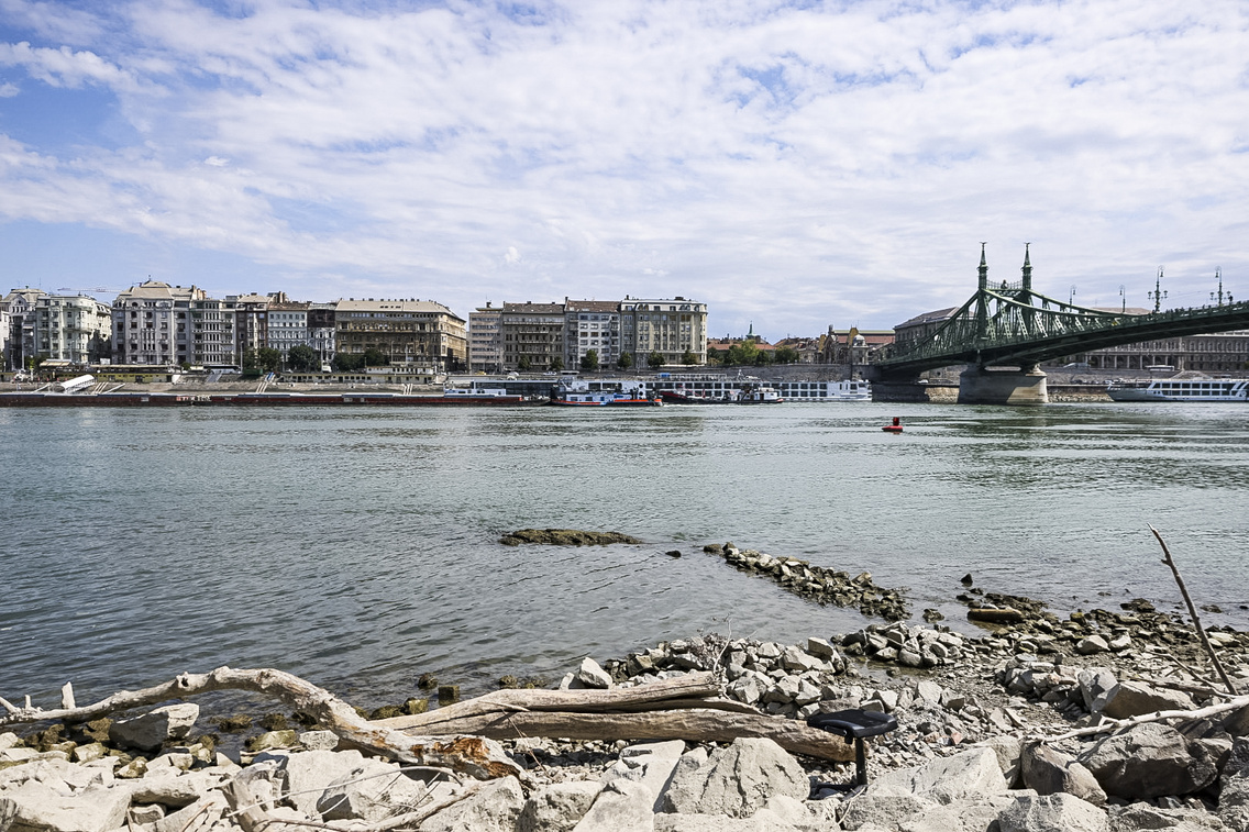
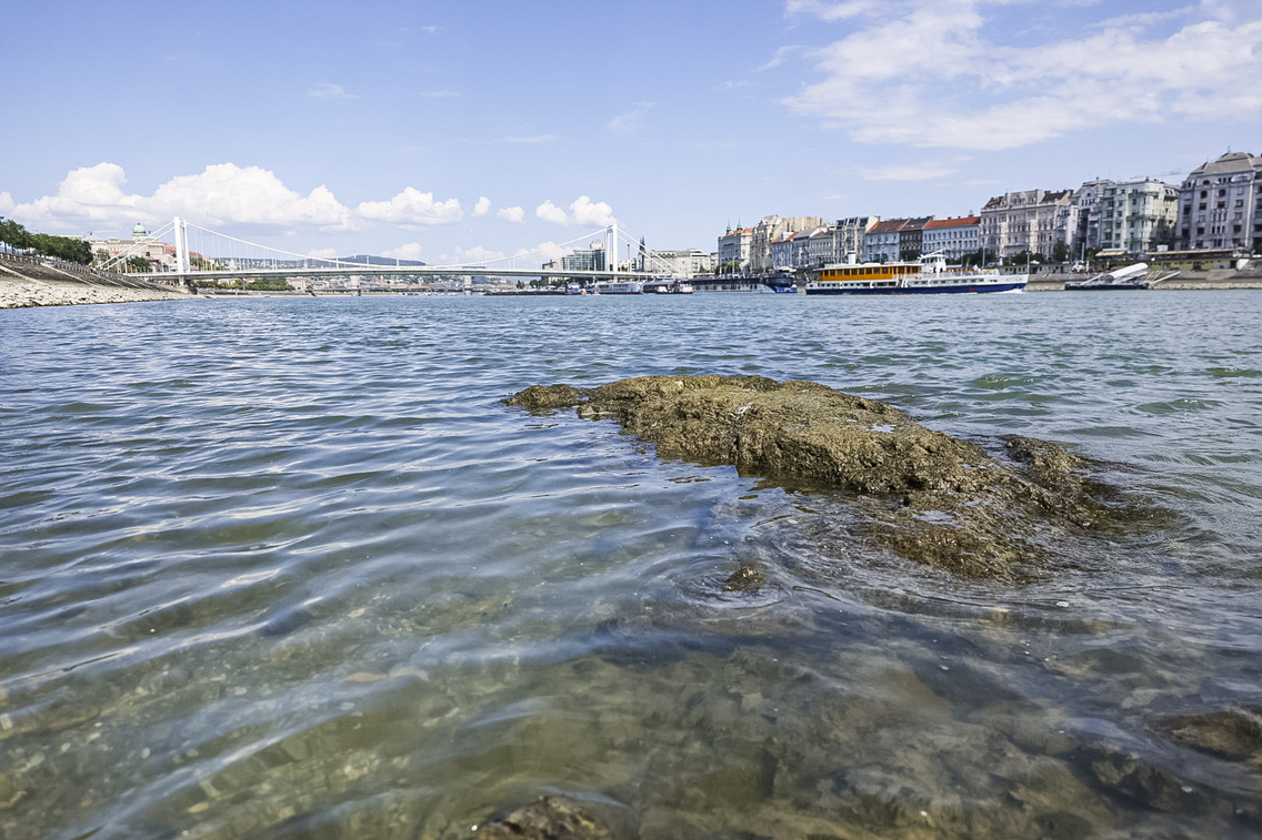
On 10 March, the Danube's water level dropped to a rare low, and with it, the Ínség-szikla – Hunger Rock – made an appearance. This rock, usually hidden beneath the surface, only shows up when the water level hits 95 cm. Pretty wild, right?
And that's an all-time low for early March since measurements started in 1876 – something that hasn't happened in over 150 years. Forecasts predict a slight (10-15 cm) rise in the coming week, but even with that, the level will stay pretty shallow. To put it in perspective, the Danube is usually 2-10 metres deep in Budapest, so you can see why this is such a big deal. The rock near Gellért Hill isn’t just any rock, either – it’s the tip of a much larger formation that played a key role in building the Liberty Bridge.
Under the hill, around the Sziklatemplom area, several large rocks stood until the area was redeveloped. The Ínség-szikla in the riverbed is considered a continuation of these formations. Surveys done during the construction of Metro Line 4 confirmed it as a gradually deepening mass that extends well beyond Liberty Bridge. It's part of a larger shoal system that once made life difficult for sailors and later caused some headaches when tunnelling through it during the metro's construction.
Some of the prominent rocks were blasted away at the end of the 19th century during the construction of the Szent Gellért Embankment. The Ínség-szikla almost met the same fate – there were plans to remove it in 1941, and after World War II, it was nearly destroyed during the riverbed's bomb clearance. In the end, though, it managed to survive.
Though it's undoubtedly the most famous and tallest, the Ínség-szikla is far from the only significant peak in this section of the Danube riverbed. In October 2018, for example, the water levels were so low that the remnants of the previous Liberty Bridge, destroyed in 1945, became visible in the river.
(Cover photo: Gábor Szabó - We Love Budapest)

Megjelent első bookazine-unk, ne maradj le róla!
Már 15 éve lélegzünk összhangban a fővárossal. Jubileumi kiadványunkban mindent megtalálsz, ami magazinunk és eddigi munkánk esszenciája. Gasztronómia, kultúra, városi legendák és Budapest arcai, interjúk, történetek és a legjobb helyek – úgy, ahogyan mi látjuk a fővárost.
Rendeld meg itt vagy keresd a nagyobb könyvesboltokban!
hirdetés